A Mutable Log
A blog by Devendra Tewari
Project maintained by tewarid Hosted on GitHub Pages — Theme by mattgraham
Getting GPS coordinates from a picture
Most mobile phones tag pictures with GPS coordinates. It is fairly easy to obtain that information and see where that picture was taken, on Google Maps for instance. Let me go through how you can do that if you are a Windows user.
Right click on the picture in Windows Explorer and select Properties. Head over to the Details tab in the Properties dialog. Scroll to the GPS section. It should look something like this
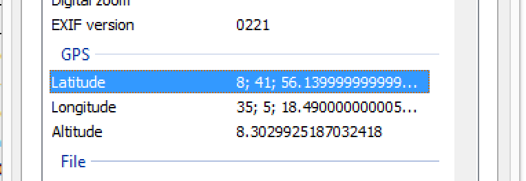
Now, let’s use the information in the image above as an example. Enter 8 41' 56.139999999999" S, 35 5' 18.490000000005" W in the search box in Google Maps. That takes me to the (almost) precise location where the picture was taken. How do I know to add S (for south) and W (for west)? I used my own good judgement, since that information is hidden in the image shown above.